

Date: 14/02/2023
Wainwrights: Souther Fell (522m), Blencathra (868m), Mungrisdale Common (633m), Bannerdale Crags (683m), Bowscale Fell (702m)
Start/Finish: Mungrisdale Village
Total Distance: 11 miles
Time Taken: A leisurely 7 Hours
 |
| The Route : Clockwise from Mungrisdale |
A Video of the Hike
I've climbed Blencathra twice before, but never the surrounding fells. And so todays objective was to remedy this and climb all the fells in the Blencathra group, as well as Blencathra itself via Sharp Edge. I'd chosen a circular route from Mungrisdale and set of at first light on a cold, clear day.
 |
| Sunrise near Great Mell Fell |
Its a nice gentle stroll up to the summit ridge of Souther Fell along a good path though the bracken. The summit is just a slightly higher grassy mound from all the others on the summit plateau.
 |
| The path up Souther Fell |
 |
| View of Blencathra from Souther Fell Summit |
A good path follows the western shoulder of Souther Fell until it drops down to the Glenderamackin valley. Another path then follows the flanks of Scales Fell up towards Scales Tarn.
 |
| Looking up to Sharp Edge and Foule Crag |
 |
| Scales Tarn |
From Scales Tarn there is a clear choice of routes up onto Blencathra summit. An easy path can be followed to the south, or the more challenging route along Sharp Edge and Foule Crag can be attempted. If the weather is inclement, particularly if wet and/or windy then I would strongly suggest the easier option.
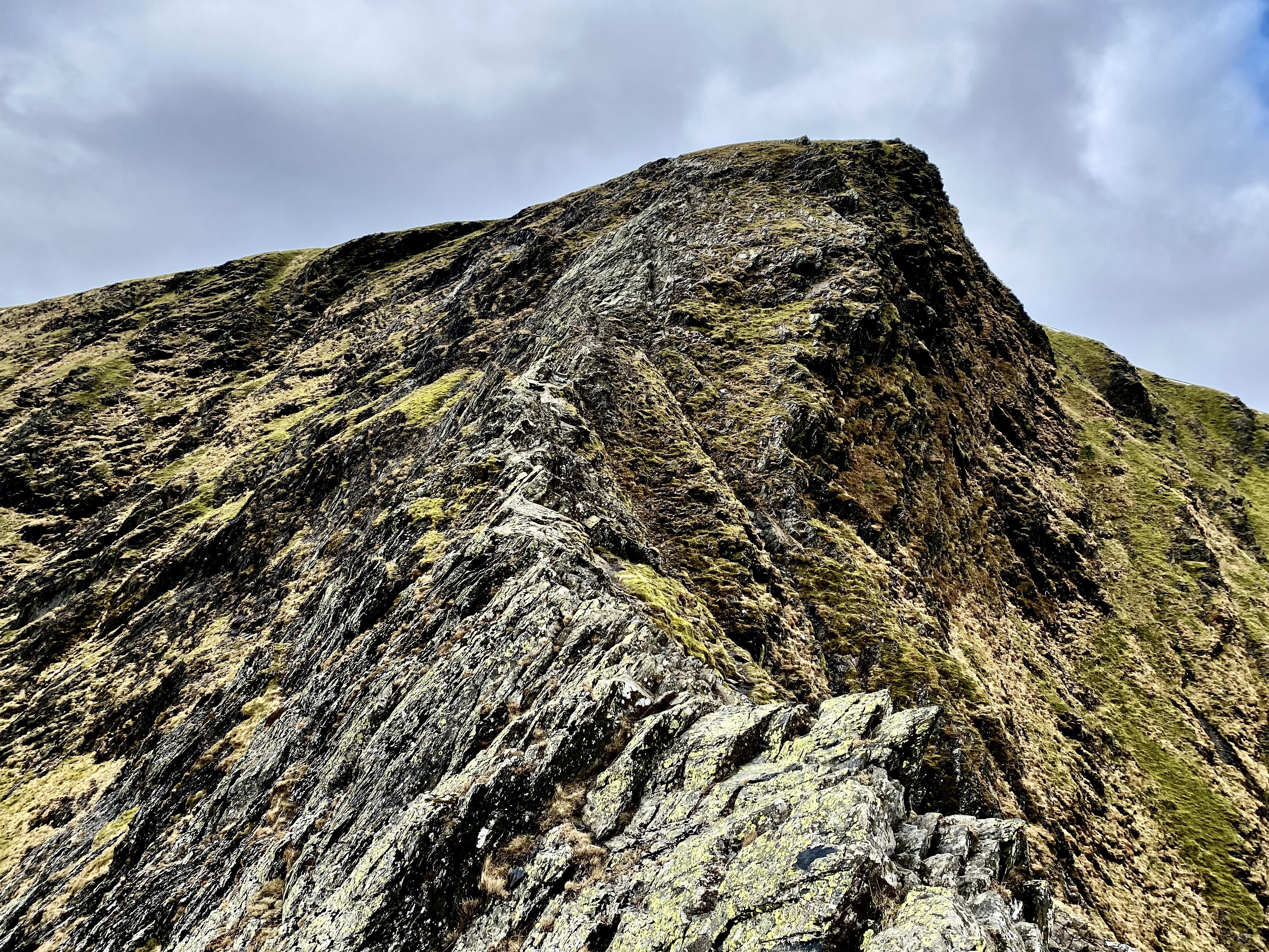 |
| Sharp Edge & Foule Crag |
 |
| Looking back along the ridge |
Every Step along Sharp Edge
Once sharp edge has been safely traversed, the difficulties are not yet over. Facing you is a angular rocky outcrop called 'Foule Crag'. This is a hand and foot scramble which demands 10 minutes of further concentration until the summit plateau is reached. Then you can finally relax and enjoy a pleasant 5 minute stroll up to summit of Blencathra where stunning views in all directions are an ample reward for your efforts.
The next objective was the somewhat bland and uninviting grassy mound of Mungrisdale Common. For those who have no desire to 'collect Wainwrights' then I would advise avoiding the 90 mins of torment required to cross, and then re-cross the boggy terrain in order to bag this particular summit. Your feet and knees will certainly appreciate it.
 |
| Mungrisdale Common is the grassy lump in the mid ground |
 |
| The summit of Mungrisdale Common |
Bannerdale Crags is the next fell on the route. As it is approached from the western side it looks decidedly un-craggy, as the drama is hidden from view on its east facing aspect. This was a perfect place to stop for a brew and a bite to eat.
 |
| Bannerdale Crags summit - looking back towards Blencathra |
Bowscale Fell is clearly visible to the north and a good path arcs around the head of the Bannerdale valley to reach it. The return path drops down to the valley and follows Bannerdale Beck back to Mungrisdale Village.
 |
| Bowscale Fell summit |
This hike brings the Wainwright total to 198. The next hike will tackle the 4 fells to north of Blencathra which will then complete the Northern Fells.


